Flood Plains and Karst Areas
The Iowa Department of Natural Resources (DNR) regulates development and structures in the flood plain as do local governments. Confinement feeding operation structures are prohibited in the 100-year flood plain. Open feedlot operations located in the flood plain of certain streams are required to obtain a floodplain permit. The DNR also regulates livestock operations located in areas of karst topography requiring more stringent standards to protect the groundwater.
Floodplains
Iowa law prohibits confinement feeding operation structures from being located on alluvial soils unless the DNR determines that the site is not located in the 100-year flood plain. Distance requirements apply to all animal feeding operations (AFOs), including small animal feeding operations (SAFOs). To determine if a proposed site in on alluvial soils, the DNR has an interactive map available called the AFO siting atlas.
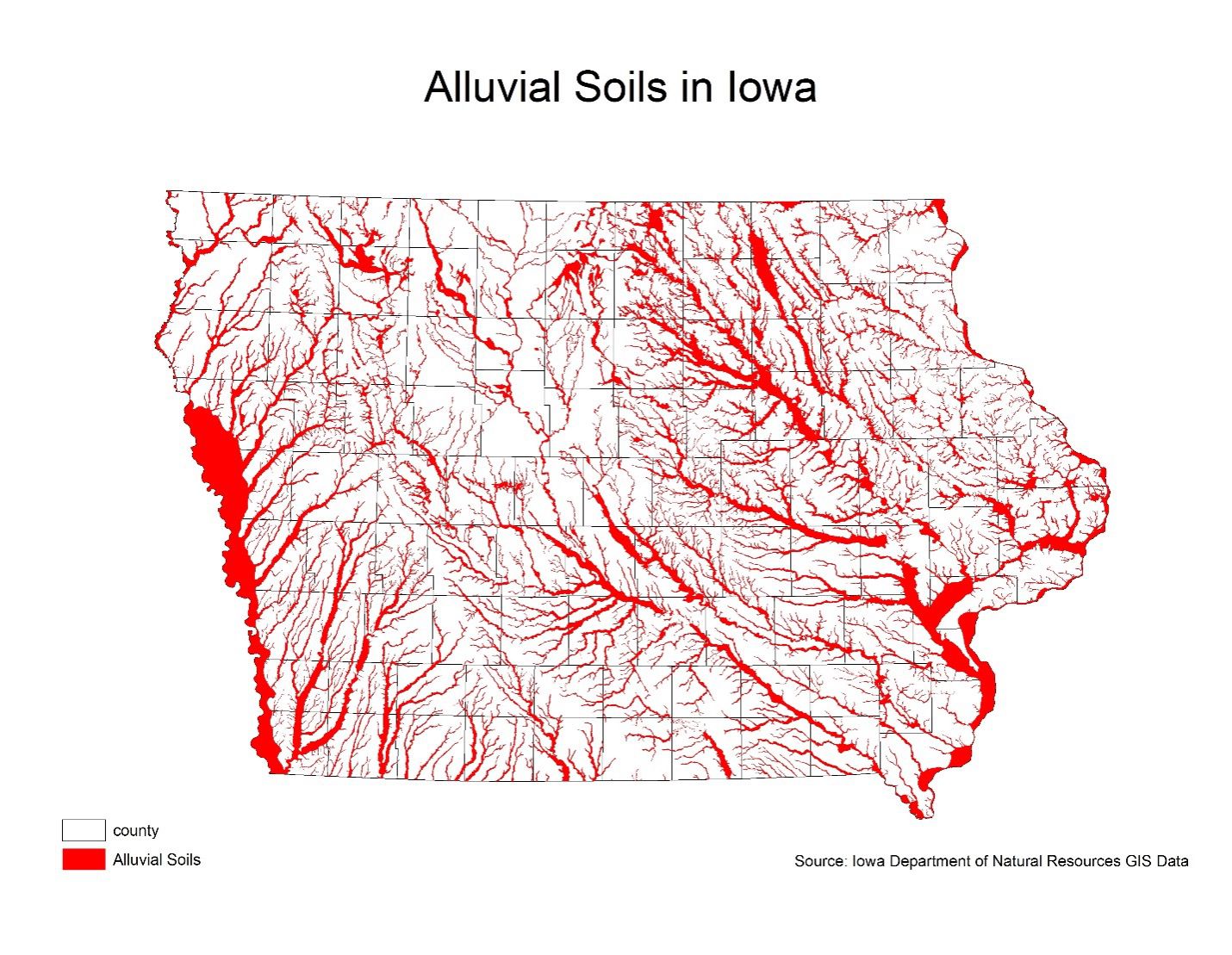
If the AFO siting atlas reveals that a proposed site is in a regulated area (alluvial or potential karst), the AFO database should be checked to see if a site has been proposed there in the past. If it has, the documents may be used to refute the determination of alluvial soils or karst topography. The documentation needed to refute the classification as alluvial must include:
- Name and qualification of soils professional.
- Color NRCS soils map with soils description including parent material and flood frequency.
- Copy of topographic map indicating creek elevation and proposed site elevation.
- Copy of Federal Emergency Management Agency (FEMA) Flood Hazard or Flood Insurance Rate Map (FIRM) if available.
- Copy of AFO Siting Atlas showing locations of proposed structures.
If the project is less than 1000 animal units (AUs), and uses formed storage, the documents should be sent to the appropriate DNR field office. If the proposed project is 1,000 AUs or greater OR uses earthen (unformed) storage, then submit all documentation with the construction permit application. Flood Plain staff have 30 days to respond and will send the documents to the appropriate DNR field office.
If there is no documentation to use for refuting the alluvial designation, a declaratory order or a flood plain determination needs to be obtained from the DNR flood plain section before proceeding with plans for that location. A planned site that is smaller than 1000 AUs, needs to file a petition for a declaratory order with DNR form 542-8157. This form may also be filled out and submitted online through the DNR PERMT website. A planned site with 1,000 AUs or larger must receive a flood plain determination and submit a construction permit with DNR form 542-1428.
If any part of an open feedlot operation is located in the flood plain or floodway, a floodplain permit may be required. Open feedlot structures are required to obtain a flood plain permit for construction, operation, and maintenance when the structure is on the flood plain or floodway of any stream draining more than ten square miles (two miles in an urban area) or if the structure will be in an area that is lower than the top of a dam. The permit application can be found on the DNR’s web site.
Local jurisdictions also have floodplain ordinances with additional restrictions on structures so also visit your county’s web site or call the zoning administrator or engineer for these regulations.
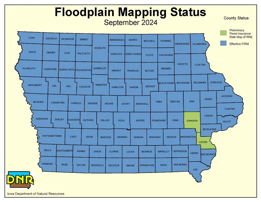
In the past, floodplain maps showing areas of risk were created by examining streams and planning for overflow. These maps outlined areas based on a 1% (100 year) risk of flooding. This approach has recently been determined to be outdated and incomprehensive. In more recent years, the DNR has now been using LiDAR overflights and HEC-RAS 6.0 software to create 2D maps of flood risk in areas of the state. Recent areas mapped with LiDAR can be found here. These new maps show more precise graduated risk of flooding. The 2D flood risk maps created with the software can be found here. The Iowa Flood Center and DNR has used this information to help counties obtain federal approval for county-wide Flood Insurance Rate Maps (FIRMs) as seen below.
If an open feedlot wishes to build in an area designated as a flood plain, they must first receive approval from the DNR and often also a US Army Corps of Engineers Clean Water Act section 404 Dredge and Fill Permit. To check if these permits are needed for a project, please use the DNR screening tool. If permits are needed, this application allows for online submission.
Karst
Karst areas are formed when underground rock erodes and creates open space for water to flow. This prevents water from being naturally filtered, and people drawing from wells in these areas may have water supply challenges. These areas also present higher risk of sinkholes forming.
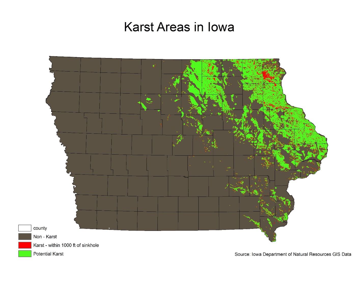
The IDNR has also created a digital map, called the AFO siting atlas, showing areas of karst or potential karst, which allows for a closeup view of potential sites and storage areas.
In areas of karst terrain, there are strict requirements for stockpiling manure as found on the stockpiling webpage. Increased standards for concrete are one of the requirements, but projects are exempt if they are less than 500 AUs. To refute the determination of an area as karst, a well record may be used so long as it meets the following requirements:
- taken by a certified well driller, NRCS-qualified staff, or soils professional,
- taken from within 200 feet of the site, and
- shows more than 25 feet of unconsolidated material (low permeability soil) between the bottom of the proposed structure and the bedrock surface.
If no previous documentation is found, a soil investigation is required to determine vertical separation from bedrock, and it must include:
- a clear indication of the locations of the borings relative to the proposed structure
- a description of the subsurface materials
- clear documentation that a separation distance to bedrock will be met, including information about the depth of the proposed storage structure relative to the ground surface
- the name of the qualified individual who completed the investigation
If the project is less than 1000 AUs, the documents should be sent to the appropriate DNR field office. If the proposed project is 1,000 AUs or greater, then submit all documentation with the construction permit application.
For more information, see DNR Guide.
Disclaimer: This document is intended for general informational purposes only and is not meant to provide legal advice for your specific situation or to infer an attorney-client relationship. Please contact your legal representative with any questions regarding your rights and available options. This document was last updated July 28, 2025 and may not reflect the most recent changes in the law. For additional information, contact your county Farm Bureau office.